
Understanding Tides for Safer Coastal Boating
The Moon and Sun set the tide’s rhythm, but weather can shift the waterline beyond a tide table’s prediction. Understanding tides for coastal boating means reading both influences: strong onshore winds can raise water levels, while offshore winds may leave less depth than expected. That difference matters when a narrow channel leaves little room to manoeuvre.
It’s easy to treat a tide prediction as the whole picture. The Moon’s and Sun’s gravitational pull drives the regular rise and fall, while wind and storms can affect the water actually present along the coast. A forecast is a guide, not a complete passage plan.
This guide explains how tides and currents work, why their effects vary around Australia, and how changing water levels can affect draft, clearance and control. You’ll learn why currents can be strongest in constricted waterways, what slack water means for a passage, and how to factor weather into your understanding of coastal conditions. The aim is practical confidence: knowing what’s moving beneath and around your boat before committing to a route.
Key Takeaways
- Use tide predictions as a guide, and account for wind and storm conditions that can shift coastal water levels.
- Recognise flood and ebb currents as changing flows that can affect your speed, control and route through an inlet.
- Factor current strength and slack water into narrow-channel passage planning.
- Compare your vessel’s draft with charted depths and the predicted tide height, allowing for changing conditions along the route.
- Understand how the Moon’s and Sun’s gravitational pull drives tides, while local geography shapes their effects.
Can weather affect tides?
Yes. Tide tables predict regular astronomical patterns, but wind and storms can shift coastal water levels and affect the conditions a vessel encounters. For Australian coastal boating, pair local tide predictions with current information and marine GPS, especially when entering shallow channels.
Weather effects on tide height
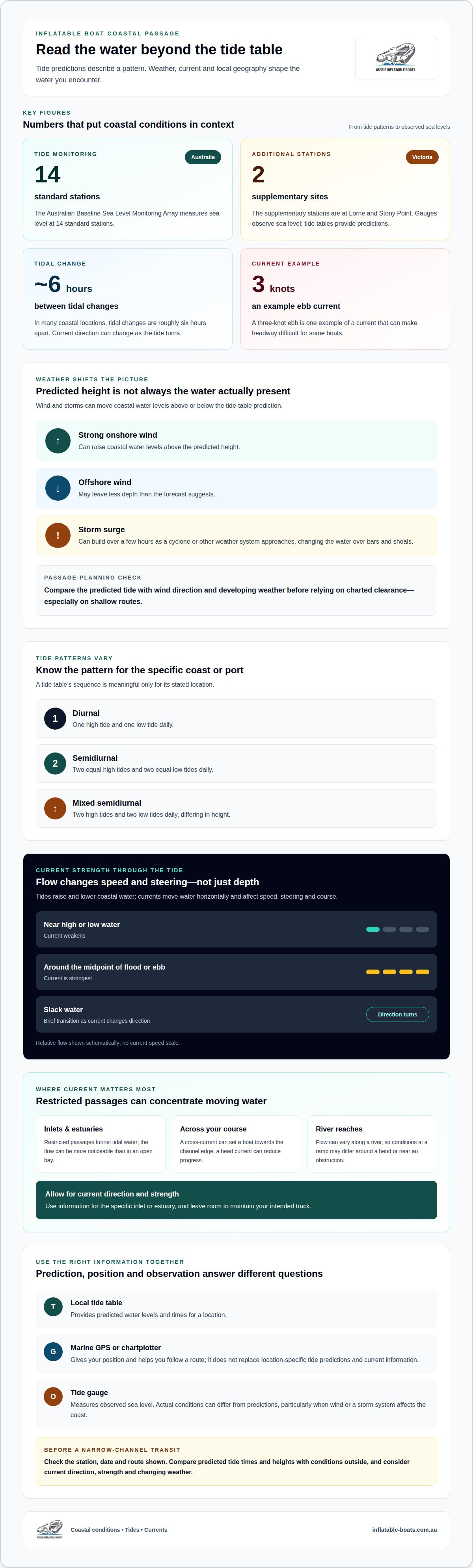
Weather can push actual water levels above or below the height predicted for a tide. Strong onshore winds can raise coastal levels, while offshore winds may reduce depth below the forecast. Storm surges can build over a few hours as a cyclone or other weather system approaches, changing the water available over bars and shoals. In tropical systems, a surge can substantially alter normal tidal conditions. On a shallow route, compare predicted levels with wind direction and developing weather before relying on charted clearance.
Weather effects on tide timing
Weather can change when observed high or low water occurs compared with its predicted time. Wind and storm effects interact with local coastlines and water movement, so the tide table remains a prediction, not a live reading. This matters when timing a channel transit: delays or water-level changes can affect both depth and current. Treat changing weather as a reason to reassess the passage, not as a precise correction to the published time.
Tidal patterns also vary by type. A diurnal pattern has one high tide and one low tide daily; a semidiurnal pattern has two equal high tides and two equal low tides daily. Mixed semidiurnal patterns have two highs and two lows that differ in height. Learn the pattern for the specific Australian coast or port you’re travelling, because a tide table’s sequence is meaningful only for its stated location. The Moon drives the regular ebb and flow, while local conditions shape what you experience.
For Australian coastal navigation, use tide tables for your boating area alongside a marine GPS or chartplotter. Don’t treat an app as a substitute for location-specific tide predictions and current information. Check the station, date and route shown on the display, then compare predicted tide times and heights with conditions outside. GPS gives your position and helps you follow a route; tide information describes predicted water levels. They answer different questions, especially in narrow channels.
Tide gauges provide observed sea-level measurements that help describe changing water levels. The Australian Bureau of Meteorology’s Australian Baseline Sea Level Monitoring Array has 14 standard stations and 2 supplementary stations at Lorne and Stony Point in Victoria. These stations measure sea level, while a tide table provides predictions for a location. Keeping that distinction clear helps explain why actual conditions can differ from predicted levels, especially when wind or a storm system affects the coast.
What Are Tides and Currents?
Tides are the rise and fall of coastal waters; currents are water moving horizontally. For a vessel underway, that distinction matters: water level affects depth, while current affects speed, steering and course. A useful part of understanding tides for coastal boating is recognising how these two movements interact along a route.
Flood and ebb currents
A flood current flows landward with the incoming tide, while an ebb current flows seaward as the tide falls; slack water is the brief transition between them. These phases affect cruising, fishing and passage planning. In many coastal locations, tidal changes are roughly six hours apart, and the current can change direction as the tide turns.
Current strength varies through each stage. Flow is strongest around the midpoint of an incoming or outgoing tide, then weakens near high or low water. A boat moving against an ebb current may make less progress over the ground than its speed through the water suggests. Consider the current’s direction in relation to your course, particularly when leaving an inlet.
Tidal currents in inlets and estuaries
Inlets and estuaries funnel tidal water through restricted passages, making currents a key navigation factor. The same volume of water moving through a narrow channel can create a more noticeable flow than in an open bay. A current across your course can set the boat towards the channel edge, while a head current can reduce progress.
Use current information for the specific inlet or estuary, not just the open-coast tide time. In an estuary, river flow meets the incoming or outgoing tide, and the combined movement can affect steering and anchoring. A three-knot ebb is one example of a current that can make headway difficult for some boats. Account for current direction and strength, and leave room to maintain your intended track.
Inland Australian rivers can have swift currents influenced by seasonal changes and tides. Flow may vary along a river, so conditions at a boat ramp might not reflect those around a bend or near an obstruction. In unfamiliar waters, account for flow rates and possible hazards before choosing a route. Moving water can also affect how a vessel lies at anchor.
Understanding tides for coastal boating also means recognising that wind-driven currents can affect large lakes, even where tides have little influence. Across Australian waters, distinguish whether movement comes from tidal flow, river discharge or wind. That helps explain why a tide prediction alone can’t describe every current affecting a passage. For fishing, moving water can stir prey and influence where predatory fish feed.
Slack water and narrow-channel navigation
Slack water is the period when a tidal current briefly weakens as it changes direction. In a narrow channel, this pause can make steering easier, but it doesn’t remove hazards such as shallow patches, rocks or cross-currents. Timing a passage around the local current cycle helps you judge how much the water may push your boat off course.
Slack water doesn’t necessarily coincide with high or low tide. The transition depends on the waterway, so a nearby tide time alone may not describe current conditions at a channel entrance. Use local current information for the passage, then consider how the flow will affect your approach, turn and exit. A boat entering against a strong current may lose progress; a cross-current can push it towards the channel edge.
Spring tides generally bring a larger tidal range, while neap tides have a smaller range. In areas with two high tides and two low tides daily, spring tides typically occur about every 15 days. For Australian boaters, the changing range can influence available depth and current strength, so a route that suits a neap tide may behave differently during a spring tide. Low water can expose hazards that were covered earlier.
Local knowledge matters in coastal waters because channels, bars and estuaries each have their own shapes and flow patterns. A chart may show a marked route, but shifting sand or a submerged obstruction can change the practical passage. In rivers, tidal movement can interact with river current, making steering or anchoring more difficult during a change of tide. Familiarise yourself with the route’s known hazards and the conditions that affect them.
There is no tide phase that makes every Australian coastal bar safe to cross. A suitable crossing depends on the bar’s depth, the current’s direction and strength, and sea and weather conditions at the time. An opposing current can make a passage more challenging, so assess the combined conditions rather than relying on high tide or slack water alone.
For narrow-channel navigation, build a clear picture of the route before departure. Identify shallow sections, bends and possible obstructions on the chart, then consider how the current could set the boat off course at each point. If conditions change during the passage, reassess whether your intended track remains suitable. This measured approach helps you account for tidal effects on coastal and river navigation, rather than treating water movement as a simple rise and fall.
Water levels relative to mean water level
A tide height describes the water level relative to a reference level at that location. For coastal navigation, the practical question is how much water remains over the shallowest part of your route.
Water levels above and below mean
A tide chart shows how high or low water is relative to the mean water level for its location. The tidal range is the difference between high and low tide, and it varies widely around Australia. South-west Australia has an average tidal range of less than 1 m, while north-west Australia’s range is more than 8 m. These regional differences affect how much predicted height changes the depth available over a shoal, reef or channel entrance.
Use the chart’s reference level to interpret tide heights, then compare the prediction with charted depth along your route. A height above the reference adds water to the charted depth; a height below it leaves less. Local wind and weather can also shift actual water levels away from predictions, so don’t treat the calculated depth as the only factor.
High and low water effects on boats
High water can provide more clearance over a shallow area, while low water can reduce depth and expose previously submerged hazards. The difference is pronounced in north-west Australia: during large spring tides, water levels can change by more than 11 m in one day. At Derby, Western Australia, tides can change by more than 11.5 m in as little as 6 hours. Port Phillip in Melbourne, by contrast, typically has changes of less than 1 m.
Consider the full tidal range when docking or anchoring. A boat secured at high water may sit on the bottom as the tide falls, making departure difficult or causing damage. Lines and depth also need to accommodate changing water levels and tidal currents, not just conditions on arrival.
Shallow-water depth and grounding risks
Grounding risk rises when the water depth along a route is less than the boat’s draft plus the clearance it needs. Compare the draft with charted depth and predicted tide height at the shallowest point, not just at departure and destination. A sandbar or rock covered at high water may be exposed at low water, and actual depth can be lower than expected during spring lows.
Leave a safety margin for unexpected shallow spots and changing conditions. A channel that appears passable near high water may become too shallow later in the passage. Timing departure around higher or incoming water can reduce grounding risk, but consider depths along the entire route.
Shallow water and seagrass risks
Seagrass can be damaged when a boat travels through water too shallow for its depth and propulsion. Low water may expose a seagrass bed or leave less clearance above it, even where the area was submerged earlier. Use tide predictions to understand changing levels, then avoid cutting across shallow flats when available depth is uncertain.
At anchor, account for the tidal range and the seabed beneath the boat. A falling tide can leave a vessel grounded, while movement over a shallow seagrass bed can disturb the habitat. Choosing a route and anchoring position with adequate water helps protect both your vessel and coastal waters.
Gravitational causes of tides
Tides are the rise and fall of sea levels caused by the gravitational pull of the Moon and Sun. Their combined influence creates predictable patterns, but the local result depends on coastline shape, water depth and geography. For boaters, understanding this mechanism explains why tidal predictions follow a regular cycle, while the depth and current experienced in a particular estuary or narrow channel can vary.
The Moon’s gravity acts across Earth’s oceans, drawing water into a bulge on the side facing the Moon. A second bulge forms on the far side, while water shifts away from areas roughly 90 degrees from the Moon’s meridian. As Earth rotates through these bulges, coastal locations experience changes in water level. This gravitational process is the underlying driver; local geography shapes how it appears on the shore.
The Sun also exerts a gravitational pull on Earth’s water, and its position relative to the Moon influences tidal range. At full and new moons, the Sun, Moon and Earth align more closely, producing higher high tides and lower low tides. These tides, with a greater range, are called spring tides. Around quarter moons, the gravitational effects combine differently, and tides are closer to average for the location.
The Moon’s orbit is elliptical, so its distance from Earth changes. As it approaches Earth, its gravitational influence can combine with a spring tide to produce a perigean spring tide. In some places, this can raise water levels enough to contribute to flooding. For a coastal passage, the practical point is that the lunar phase and the Moon’s position affect the predicted range, not just the daily tide time.
Gravity sets the broad pattern, but it doesn’t explain every detail of a local tide. Coastline shape, seabed contours and the layout of bays or estuaries influence how water moves and where currents accelerate. A broad bay and a narrow inlet can therefore respond differently to the same astronomical forces. Tide tables use predictions for specific locations because local conditions shape the height and timing observed there.
Apply this knowledge by treating the tide prediction as a location-specific guide. Identify the Moon phase, then read the relevant local tide heights and times alongside current information for your route. A spring tide can increase the tidal range, but its effect on a particular channel depends on local depths and geography. The key takeaway: gravitational forces drive the cycle, while the coast determines how that cycle affects your passage.
Inflatable Boats
Inflatable Boats supports coastal boating with inflatable boats, accessories, spare parts and repairs. Tide knowledge helps you plan around changing water, currents and channel depth; suitable equipment and a well-maintained vessel are also part of preparing for time afloat. Turn to Inflatable Boats when you’re considering an inflatable boat, need an accessory or spare part, or require a repair. These offerings support your boating setup, but they don’t replace local tide information or route planning. Match your vessel and equipment needs to the waters you intend to explore, then use the tide and weather factors covered above to shape your passage. For help with your boating needs, contact Inflatable Boats.
Build confidence for your next passage
Make understanding tides for coastal boating a habit that develops with every trip. Keep a brief passage log after returning, noting the conditions you encountered and how they compared with your plan. Over time, these observations can help you recognise how familiar stretches of coast behave and make more considered decisions before setting out.
Your boat and its equipment are part of that preparation. If you’re considering an inflatable boat or need accessories or spare parts for your setup, choose options that suit how you use the water. Inflatable Boats offers inflatable boats, accessories, spare parts and professional repair services.
Contact Inflatable Boats today to discuss your boating needs. Keep learning, prepare with care, and enjoy the freedom of your next coastal adventure.
Frequently Asked Questions
What Causes Tides?
Tides are caused by the gravitational pull of the Moon and Sun on Earth’s oceans. As Earth rotates, coastlines move through areas of raised water, producing changing sea levels. The Moon’s position strongly influences timing and range, while the Sun’s alignment can increase or moderate those effects. Coastal shape and seabed depth then influence how the tidal pattern appears at a particular location.
Why are tides important for boating?
Tides matter because they change the depth beneath your boat and influence current direction and strength. A route with adequate clearance at departure may become too shallow later, while a current can affect speed and steering. For example, a boat entering a narrow channel must account for both available depth and water moving across its course. Tide awareness helps you plan a passage around these changing conditions.
How do I know if a tide is safe for my boat?
There isn’t one tide height that’s safe for every boat or route. Compare the predicted water level with charted depth and your vessel’s draft, then consider the current, weather and shallow points along the whole passage. A route may offer sufficient depth at its entrance but less over a bar or shoal farther on. If conditions don’t suit your vessel or experience, choose another time or route.
How often do tides change?
Tidal timing varies by location and pattern. Many coastal places experience two high tides and two low tides during a lunar day, with tidal changes roughly six hours apart. Some locations instead have one high tide and one low tide daily, while mixed patterns have unequal highs or lows. The local tide table shows the sequence and times for its reference location, so use that location when planning.
Should I check tides before every trip?
Yes. Check tide predictions for your route and trip time before each coastal outing, even if you know the area. The tide affects depth and currents, and weather can shift actual water levels from the prediction. A familiar entrance may behave differently at another tide stage or in different wind conditions. Include the return leg in your plan, as water levels and current direction may change while you’re afloat.
What Is the 50-90 Rule for Tides?
The phrase can refer to a rough way of thinking about changing tidal flow, not a guaranteed passage calculation. Current flow is often strongest around the midpoint of an incoming or outgoing tide, roughly 50% through that stage, and weakest near the high- or low-water extremes, around 10%. Local geography affects the pattern, so use current information for your route rather than treating the percentages as exact timings.
What is a tide chart?
A tide chart displays predicted high and low water times and heights for a particular location. Its height readings use a local reference level, so they indicate water level relative to that benchmark rather than a universal depth. Use the chart with nautical chart depths to estimate available water along your route. Check that the station matches your boating area, since a nearby location can have different predictions.
How do tides work, and what causes high and low tides?
The Moon’s and Sun’s gravitational pull causes ocean water to form broad tidal bulges. As Earth rotates, a coastline passes through these raised-water areas and the lower areas between them, producing high and low tides. The Moon’s orbit and changing position relative to the Sun influence the tidal range. Bays, estuaries and narrow inlets reshape the local response, so the same astronomical cycle can produce different conditions around the coast.